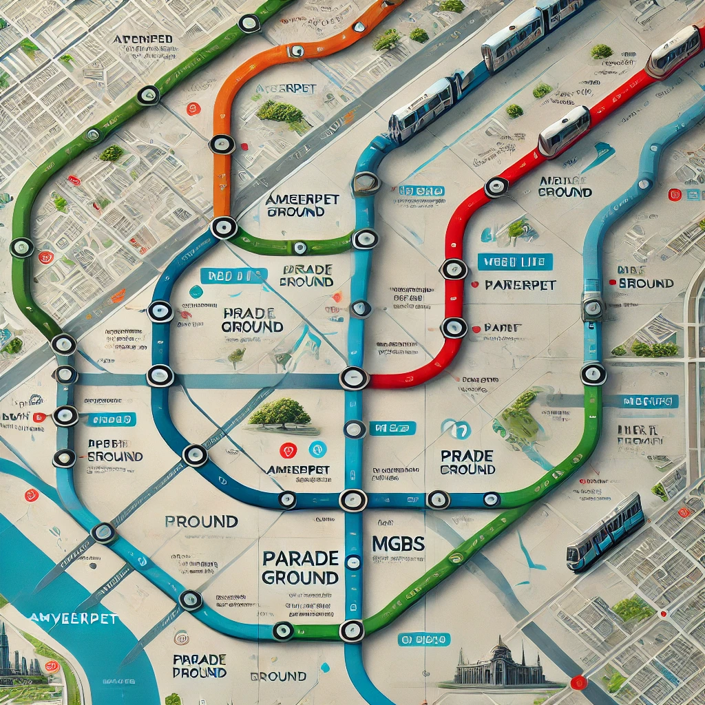
Hyderabad Metro Train Map showing Red, Blue, and Green line routes, key metro stations, and interchange points.
Hyderabad, the bustling capital of Telangana, is known for its rich heritage, thriving IT hubs, and modern infrastructure. Among its most significant urban developments is the Hyderabad Metro Rail, a fast, efficient, and eco-friendly mode of transportation for daily commuters and tourists alike.
Whether you’re a local resident or a visitor, understanding the Hyderabad Metro Train Map can save you time, effort, and money. This article will provide a complete guide to Hyderabad Metro’s route map, key stations, timings, ticket options, and essential travel tips.
1. Overview of Hyderabad Metro Rail
The Hyderabad Metro Rail is one of India's largest public transport systems, spanning a total length of 69.2 km. It operates on three main corridors (routes), each color-coded for easy identification. The metro connects key parts of the city, including residential areas, business hubs, shopping malls, and tourist attractions.
Key Features of Hyderabad Metro
- Total Routes: 3 Corridors (Red, Blue, Green)
- Total Stations: 57 operational stations
- Total Length: 69.2 km
- Timings: 6:00 AM to 11:00 PM (may vary)
- Frequency: Every 3 to 5 minutes during peak hours
2. Hyderabad Metro Train Map (Routes & Stations)
The Hyderabad Metro Train Map is divided into three color-coded corridors, making it easy for passengers to identify their routes. Here’s a breakdown of each route.
1. Red Line (Miyapur to LB Nagar)
The Red Line is one of the most widely used corridors, linking the residential areas of Miyapur to the commercial areas of LB Nagar. It cuts through key areas like Ameerpet and Koti, which are popular shopping hubs.
Key Stations on the Red Line
- Miyapur (Starting Point)
- JNTU College
- KPHB Colony
- Kukatpally
- Ameerpet (Interchange Station)
- Panjagutta
- Khairatabad
- Lakdi-ka-Pul
- Assembly
- Nampally (Hyderabad Railway Station)
- Koti
- Malakpet
- LB Nagar (Terminus)
Total Distance: 29.2 km
Total Travel Time: Approximately 45 minutes
2. Blue Line (Nagole to Raidurg)
The Blue Line connects the eastern residential areas with the IT corridor of Hitec City and Raidurg, where most corporate offices and tech parks are located. This line is highly popular among office goers.
Key Stations on the Blue Line
- Nagole (Starting Point)
- Uppal
- Stadium
- Tarnaka
- Mettuguda
- Secunderabad (Railway Station Interchange)
- Parade Grounds (Interchange with Red Line)
- Begumpet
- Ameerpet (Interchange with Red Line)
- Madhura Nagar
- Yousufguda
- Jubilee Hills Check Post
- Hitec City
- Raidurg (Terminus)
Total Distance: 27 km
Total Travel Time: Approximately 40 minutes
3. Green Line (JBS Parade Ground to MG Bus Station - MGBS)
The Green Line is a shorter corridor connecting JBS Parade Ground (Jubilee Bus Station) to the Mahatma Gandhi Bus Station (MGBS). This route makes it easier for passengers to connect between the city’s two largest bus stations.
Key Stations on the Green Line
- JBS Parade Ground (Starting Point, Interchange with Blue Line)
- Secunderabad West
- Gandhi Hospital
- Sultan Bazar
- MGBS (Interchange with Red Line, Terminus)
Total Distance: 11 km
Total Travel Time: Approximately 20 minutes
3. Hyderabad Metro Train Map (Image)
Note: To view the official Hyderabad Metro Train Map, you can visit the official Hyderabad Metro website or access it via metro stations and tourist information centers.
If you'd like, I can generate a realistic Hyderabad Metro Train Map showing all the routes, stations, and interchange points. Let me know!
4. Hyderabad Metro Timings and Frequency
- Operational Hours: 6:00 AM to 11:00 PM (Monday to Sunday)
- Frequency: Every 3-5 minutes during peak hours and 8-10 minutes during non-peak hours.
5. Ticket Options and Fare Details
There are several options for purchasing Hyderabad Metro tickets:
- Single Journey Ticket: Purchase a paper ticket at the counter or vending machine.
- Metro Smart Card: A rechargeable card that offers a cashless and faster experience. Regular commuters prefer this option as it saves time and offers small discounts.
- Mobile App: Book tickets online using the Hyderabad Metro Rail app.
Ticket Prices
- Minimum Fare: ₹10
- Maximum Fare: ₹60 (depending on the distance)
6. Top Tourist Attractions Near Metro Stations
Here’s a list of tourist places you can easily access from nearby metro stations.
- Charminar – Get off at MGBS Station (Green Line) and take an auto-rickshaw to Charminar.
- Golconda Fort – Reach Raidurg Station (Blue Line) and hire a cab or auto to the fort.
- Hussain Sagar Lake – Lakdi-ka-Pul or Necklace Road station (Red Line) is closest to the lake.
- Ramoji Film City – Take the metro to LB Nagar (Red Line) and get a cab to the film city.
- Birla Mandir – Get down at Lakdi-ka-Pul station (Red Line) and walk to Birla Mandir.
7. Benefits of Using the Hyderabad Metro Rail
- Time-Saving: Avoid city traffic and save time during peak hours.
- Affordable: Fares start from just ₹10, making it budget-friendly.
- Environmentally Friendly: Electric trains reduce carbon emissions.
- Safe and Secure: CCTV cameras, guards, and regular checks ensure passenger safety.
- Seamless Connectivity: Connects key areas of the city, including Hitec City, Secunderabad, MGBS, and tourist spots.
8. How to Plan Your Journey on the Hyderabad Metro
- Check the Route Map: Identify your starting station and destination.
- Check Interchange Points: If your journey requires a change of line, note the interchange station (e.g., Ameerpet).
- Get Tickets: Use the Smart Card, buy a single-journey ticket, or book via the mobile app.
- Plan Arrival at Station: Arrive 10-15 minutes early, especially during peak hours.
- Follow Safety Guidelines: Stay behind the yellow line, avoid overcrowded areas, and follow announcements.
9. FAQs about Hyderabad Metro Train Map
Q1. Where can I get the Hyderabad Metro Train Map?
You can find the map on the official website of Hyderabad Metro, inside the metro stations, or on travel apps like Google Maps.
Q2. How many metro lines operate in Hyderabad?
There are 3 operational corridors – Red Line, Blue Line, and Green Line.
Q3. Can I change lines without exiting the station?
Yes, you can switch lines at interchange stations like Ameerpet, Parade Grounds, and MGBS.
Q4. Is Hyderabad Metro accessible for disabled passengers?
Yes, Hyderabad Metro is equipped with escalators, elevators, and ramps for disabled access.
Q5. Are there any luggage restrictions on the metro?
Yes, passengers are allowed to carry small and medium-sized luggage. Oversized luggage may not be allowed.
Conclusion
The Hyderabad Metro Train Map is an essential tool for navigating the city quickly and efficiently. With 3 corridors, 57 stations, and multiple interchange points, the metro offers seamless connectivity to all major areas of the city. Whether you’re commuting for work, sightseeing, or daily travel, the Hyderabad Metro is a fast, reliable, and affordable option.
With this guide in hand, you’re now ready to explore the city with ease. If you have any questions or need a custom map, let me know, and I’ll create one for you!
To buy RERA certified, DTCP & HMDA approved Gated Community Villa Open Plots Please Contact :
For Sales : 8179712384
Mail : sales@openplots.net